Partly Sunny
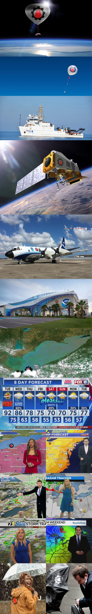
From air, thin air, and no air in space to land and sea. Huge amounts of weather data is collected then algorithms and humans make sense of it. And BAM!!!!!! It’s on TV (or an App) in a form we mortals can understand so we know whether to wear a coat or sunscreen when we go out or to bring an umbrella. Amazing stuff!!!! :))))) Please…read on.
If you know me, I’m an optimist. I prefer “partly sunny” to “partly cloudy” and wake up every day looking on “the bright side”, anxiously tackling your PIA (pain in the @%$) Jobs! Today’s no different, enjoying a gorgeous morning sunrise as I look out over the lake from my office. I’m also intrigued by something that impacts us every day – the weather. What we do, what we wear, what we talk about. As we move into Fall, the weather around here is changing – cooler in the mornings and evenings, great cloud clusters, a different “blue” sky, and sometimes a bit unpredictable during the day. Throughout the Midwest, farmers are harvesting crops, boaters are bringing in their boats, fishermen are targeting streams as fish head home to spawn, games are won and lost in the wind and rain, and most of us are moving our summer wear to the back of the closet. Through technology, we can just ask our smartphone – “what’s the weather today”, and we get instant, detailed hour by hour response. I looked up some history and found out the Nation Weather Service formally began today, over 150 years ago. Through each decade, with the steady advancement of technology, our ability to track and better predict weather grows stronger each year. Here’s some fun facts and trivia to expand your knowledge, along with a couple nice tunes for the day. Enjoy, and thanks to noaa.gov, Wikipedia and You Tube for the info and videos.
John Denver – Sunshine On My Shoulders
Aquarius (Let the Sunshine in)
Good Day Sunshine (Remastered 2009)
- On February 2, 1870, the United States Congress passed a resolution requiring the Secretary of War “to provide for taking meteorological observations at the military stations in the interior of the continent and at other points in the States and Territories…and for giving notice on the northern (Great) lakes and on the seacoast by magnetic telegraph and marine signals, of the approach and force of storms.” The Resolution was signed into law on February 9, 1870 by President Ulysses S. Grant, and the precursor to the Weather Bureau and National Weather Service was born.
- The new agency, called the Division of Telegrams and Reports for the Benefit of Commerce, was formed under the U.S. Army Signal Service. The new weather agency was placed under the War Department because “military discipline would probably secure the greatest promptness, regularity, and accuracy in the required observations.” Because of the long name, the agency frequently referred to it as the national weather service or general weather service of the United States.
- The new weather agency operated under the Signal Service from 1870 to 1891. During that time, the main office was located in Washington, D.C., with field offices concentrated mainly east of the Rockies. Most forecasts originated in the main office in Washington with observations provided by field offices.
- During the Signal Service years, little meteorological science was used to make weather forecasts. Instead, weather which occurred at one location was assumed to move into the next area downstream. The weather forecasts were simple and general in content — usually containing basic weather parameters such as cloud and precipitation.
- The Division of Telegrams and Reports for the Benefit of Commerce remained under the Signal Service until 1891. On October 1, 1890, Congress voted to transfer it to the Department of Agriculture and renamed the Weather Bureau.
- Weather forecasters in the Signal Service and early Weather Bureau years primarily used information from surface weather observations. The early meteorologists were aware that conditions in the upper-atmosphere controlled surface weather conditions, but technology had not advanced to the point of taking upper atmospheric observations.
- Around 1900, the Weather Bureau began to experiment with kites to measure temperature, relative humidity, and winds in the upper atmosphere. Kite observations were taken intermittently from about 1900 to about 1920 with a kite network of stations established during the 1920s and early 1930s. These pioneers (yes, Ben Franklin) were the first to observe classical meteorological features which significantly impacted weather over the United States. By the early 1930s, kites were becoming a hazard to airplanes in flight, causing kite observations to give way to airplane observations.
- In 1931, the Weather Bureau began to replace kite stations with airplane stations. The use of the airplane as an upper-air observational tool continued to expand during the 1930s. Airplanes were an expensive and dangerous way to obtain upper-air data. Also, it frequently was impossible to use airplanes during bad weather; the time when observations were most important.
- The development of the radiosonde was a benchmark to operational meteorology. With the relatively inexpensive instrument, the upper atmosphere could be sampled routinely and simultaneously in both bad and good weather. The radiosonde was one catalyst which increased meteorologists’ understanding of the weather. Following the implementation of the radiosonde, the science of weather forecasting began to improve substantially and steadily. How it Works
- One of the more important advances for the Weather Bureau was the advent of the teletype system. The forerunner of the teletype, the telegraph, served the early needs of the agency, but it was readily apparent that this system was labor intensive and not reliable. The system contained many vulnerable areas, any of which could result in an important warning not being received or a critical observation not transmitted.
- The teletype was introduced in the Weather Bureau in 1928 and its use spread rapidly. Within two years, teletype circuits covered 8,000 miles, mainly in the eastern part of the country, and by the mid-1930s, teletype circuits covered over 32,000 miles.
- While under the Department of Agriculture, aviation weather services of the Weather Bureau expanded rapidly. Initiation of air mail flights and the increase of aviation activity following World War I placed a large demand on the Weather Bureau for forecasts of flying weather. In 1919, daily flying weather forecasts were started primarily for the Post Office and military aviation, but the most significant advances occurred with the passage of the Air Commerce Act of 1926 which made the Weather Bureau responsible for weather services to civilian aviation, establishing a network of stations across the United States to take surface and upper-air weather observations.
- As the Weather Bureau became more associated with the aviation community, it became apparent that the agency belonged in the Department of Commerce. On June 30, 1940, President Franklin Delano Roosevelt transferred the Weather Bureau to the Department of Commerce where it remains today.
- During the late 1940s and 1950s, the main contribution to Weather Bureau operations was in the area of radar meteorology and computer models of the atmosphere. The military gave the Weather Bureau 25 surplus radars which subsequently were renovated to detect weather echoes. Information gained from the operation of these radars eventually led to the formation of a network of weather surveillance radars still in use today.
- With the development of computer technology during the 1950s the way was paved for the formulation of complex mathematical weather models to aid meteorologists in forecasting. The first operational use of these computer models during the 1950s resulted in a significant increase in forecast accuracy.
- The Weather Bureau entered the satellite age in the 1960s. The first weather photographs from space in the 1950s actually were by-products of films made to record the attitude of rocket nose cones. However, following the launch of Explorer in 1958, the importance of satellites to observing the world’s weather soon became apparent.
- Most early weather satellites were low orbit versions which viewed small and different sections of the earth’s surface. In the 1970s, geostationary weather satellites were launched which provided meteorologists with continuous observations over much of the western hemisphere.
- In July 1970, the name of the Weather Bureau was changed to the National Weather Service. At the same time, the National Weather Service was placed under the National
- Oceanic and Atmospheric Administration (NOAA) within the Department of Commerce where it remains.
- The 1970s saw considerable expansion of technology and automation throughout the agency, led by the development of the Automated Field Operations and Services system, or AFOS. AFOS was designed to bring the NWS into the modern era, using alphanumeric and digital displays to view weather maps and compose forecasts and warnings.
- In addition, radar technology and capability continued to expand. The NWS deployed new WSR-74S/C radar across the nation, while the National Severe Storms Laboratory in Norman, Oklahoma, experimented with Doppler radar technology. The Next Generation Radar Program, commonly known as NEXRAD, would revolutionize the NWS’ ability to forecast several weather.
- A super-outbreak of tornadoes in April 1974 was a turning point for the agency, spurring what became the most ambitious and successful transformation in the agency’s history: the Modernization and Associated Restructuring, or MAR. Planned in the 1980s and implemented in the 90s, the MAR modernized the agency’s observational infrastructure. NEXRAD, a new generation of environmental satellites, the Automated Surface Observation System (ASOS), and a new Advance Weather Information Processing System (AWIPS) to replace ASOS, were centerpiece technologies.
- The MAR was completed in 2000, and forecast capabilities continued to improve through the beginning of the 21s Century. However, another super outbreak of tornadoes in 2011 — eerily similar to the 1974 outbreak in both scope and lives lost — was a stark reminder that even timely warnings are only as good as the action people take in response to them.
- From the “Critical Conversations” that followed between NWS and its partners in government, the private sector and academia, the concept of Building a Weather-Ready Nation was born and a refocusing of forecasting efforts toward “the Last Mile” with Impact-based Decision Support Services. The key to creating a prepared, resilient nation is connecting forecasts to the life-saving decisions that allow communities to withstand them. IDSS is all about delivering forecasts to emergency managers and public safety officials to ensure these decision-makers make informed decisions and understand the impending situation based on expected impacts.
- The Weather Research and Forecasting and Innovation Act of 2017 codified the IDSS approach into law, authorizing the NWS to provide IDSS across federal, state, local, tribal, and territorial levels of government for the purposes of public safety and disaster management. As the NWS begins its next 150 years, the agency and its employees remain focused on one enduring mission that has remained consistent throughout its history: protecting lives and property and enhancing the national economy.
Additional Reading:
- In addition to the hotlinks incorporated throughout this story, we invite you to learn more about NWS’ storied history by exploring the entirety of the NWS Heritage website.
- Also, visit HERE for detailed history by decades.
- Latest satellite imagery around the globe.
::::::::::::::::::::::::::::::::::::::::::::::::::::::::::::::::::::::::::::::::::::::::::
DO YOU LIKE CONTESTS?
Me, too.
As you may know the Kowalski Heat Treating logo finds its way
into the visuals of my Friday posts.
I. Love. My. Logo.
One week there could be three logos.
The next week there could be 15 logos.
And sometimes the logo is very small or just a partial logo showing.
But there are always logos in some of the pictures.
So, I challenge you, my beloved readers, to count them and send me a
quick email with the total number of logos in the Friday post.
On the following Tuesday I’ll pick a winner from the correct answers
and send that lucky person some great KHT swag.
So, start counting and good luck!
Oh, and the logos at the very top header don’t count.
Got it? Good. :-))))
Have fun!!
::::::::::::::::::::::::::::::::::::::::::::::::::::::::::::::::::::::::::::::::::::::::::


Leave a Reply
Want to join the discussion?Feel free to contribute!